
Road Trip The Coast of Wales
North to South - Pt3
Parys Mountain Copper Mine
Welcome back to my tour around the coast of Wales. If you’ve missed part two, you can catch it here.
The next couple of posts will just cover Anglesey, because to be honest, Anglesey as a location can easily take a week or so to tour around properly.
Anglesey is a 260sq mile island off the northwest coast of Wales. It’s Wales’s largest island and to get to it, you have to cross the Menai Strait on either the Menai suspension bridge, designed by Thomas Telford and opened in 1826, or the Britannia Bridge, originally designed by Robert Stephenson (of the railway fame) built in 1850 and replaced in 1980 after a devastating fire.
Almost all of Anglesey's 125 mile coastline and a large chunk of other parts of the island are designated Areas of Outstanding Natural Beauty. This basically means those areas are legally protected from inappropriate development to protect both the aesthetic appeal of the coastal region and also protecting the habitats of some rare natural inhabitants of the island. Combined with numerous sites of special scientific interest, Anglesey truly is a nature lovers paradise.


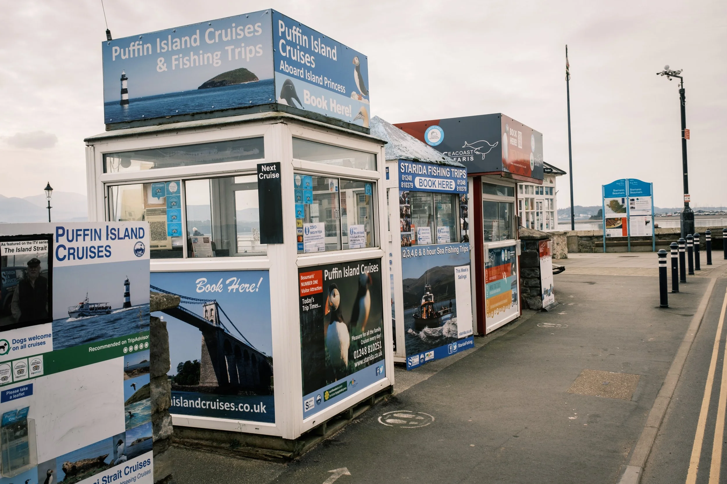
Turning right after crossing the Menai suspension bridge, our first destination is Beaumaris, (on Anglesey pronounced Beeyou-maris). Built around what’s been described as the most technically perfect castle in Britain (built by Edward the First), the town is a wonderful picture postcard place to while away an afternoon eating ice cream by the water.
Our next stop is the lighthouse at Penmon Point. It’s just one of those easily accessible places (with a small toll road fee during peak times), somewhere to while away your time, watching nature and maybe enjoying a treat from the cafe on site.


Penmon lighthouse you see today was built between 1835 and 1838. It’s 29 metres tall and in 1922 it became the very first automated Trinity lighthouse. Beyond the lighthouse, is Puffin Island, where many coastal bird species call home during nesting season. It’s also possible to sometimes watch porpoise chasing their food through the narrows between the island and the mainland.
We continue our journey anti-clockwise around the island. To be honest, almost every turn-off towards the coast will end up in a beautiful picturesque village, harbour or hamlet. Like I said earlier, it’d be impossible to cover every amazing spot Anglesey has to offer. So my next stop is Mars…


Ok, it’s not actually Mars, but Parys Mountain. Parys Mountain used to be Europe’s largest copper mine, so the ore from the mine has created a Mars-like reddish/orange landscape. The copper from Parys mountain was used to sheath the wooden warships of the British Admiralty, enabling them to remain at sea for longer periods and making them faster and more manoeuvrable, as the copper prevented growths of seaweed and barnacles. The copper coming out of Parys Mountain was so prolific in the late 1700’s, that it actually put Cornwall's own mining industry in serious jeopardy.
We’ll bypass the port of Holyhead (a big port, catch a boat here if you want to get to Ireland) and make our way to South Stack.
Right, so you know that Anglesey is an island off the northwest coast of Wales… well Holyhead and then South Stack is on an island off of the main part of Anglesey, Holy Island. With me so far? Then to be precise, South Stack is actually an island off of Holy Island… so South Stack, is an island, off an island, off an island, off the northwest coast of Wales… I think.
South Stack Lighthouse
The two main reasons for making South Stack a port of call if you’re on Anglesey are A) the wildlife and birdlife and B) the South Stack lighthouse. A footbridge joins South Stack to Holy Island after descending over 360 steps. Tickets to enter the lighthouse must be purchased at the top, so don’t realise after you’ve got down there… just saying.
Buy your tickets from the stunning RSPB visitor centre on the road through to the lighthouse. You can’t miss it, and it’s also a handy cafe and toilet stop.


From the steps above South Stack, looking back towards the mainland along the cliffs, you’ll see a small castellated white building. This is Elin’s Tower. Originally built around 1867, the building was a folly for the wife of a Minister of Parliament, whose name was, of course, Elin. It’s now owned by the RSPB as an information centre and an excellent point to observe the sea birds that inhabit this part of Anglesey, including Razorbills, Choughs, Peregrins and Puffins.
To get to our next unmissable stop on Anglesey, you’ll need to keep your eye on the tide times…